By: Dylan Book
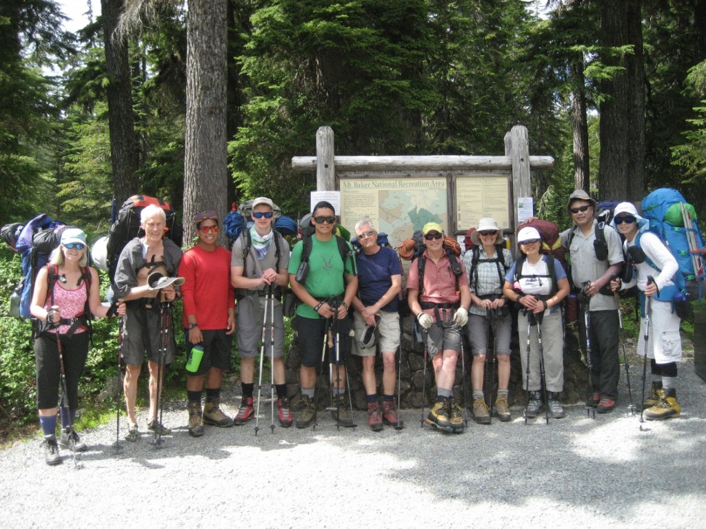
On July 22, 7 members of the 180th Pacific Coast Scout Group with 4 friends began their ascent to the peak of Mount Baker, at 10,781 ft.
But my journey to the top of Mount Baker did not begin on July 22; it began on February 8 when I first joined John Wong, Vince Poulin, Hazel Wong and Jeremy Tam for their weekly training hike up Grouse Mountain on the BCMC. The BCMC, named for the British Columbia Mountain Club, is a trail east of the well-known Grouse Grind that is perfect for mountaineering strength training. These hikes continued into the spring, and though I had no idea I would be going up Baker in July, I enjoyed the exercise and wanted to be prepared if the opportunity came up.
Unlike the Baden-Powel Trail, climbing Mount Baker is a not a “Typical Sunday Stroll.” Mountaineering is more technical than hiking or backpacking and so some skills are required. I learnt these skills at Vince’s MS.ca course in March. We learnt things like crampon and ice-axe technique that are essential on the glaciers of Mount Baker.
In June the opportunity to climb Baker presented itself and I was prepared enough to sign up. Training continued but now the goal was clear. On 2011, our scout group climbed to the top via the North side. This year, we climbed from the South side which had more crevasses thus was longer. On July 22 the ascent began.
We left the Park Buttes trailhead at an elevation of about 3300 feet, about as high as Grouse Mountain. The first part of the hike wound through Schriebers Meadows until we came to Stoney Creek. We crossed Stoney Creek by boulder jumping and then began to climb more steeply. The many switchbacks and worn trail reminded me of the BCMC.
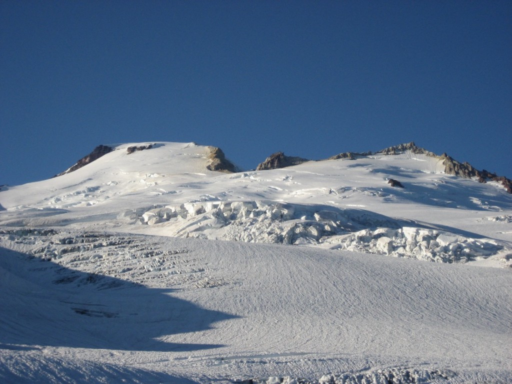
We soon broke out of the tree line onto the Morovitz Meadows and stopped for lunch with a beautiful view of Mt. Baker. The trail wound onto the Railroad Grade Trail, a high ridge over looking the moraine of the glacier. We soon took another rest to refill on water from a nearby stream near the High Camp. It’s always a treat to have glacier water so clean you drink it straight from the stream.
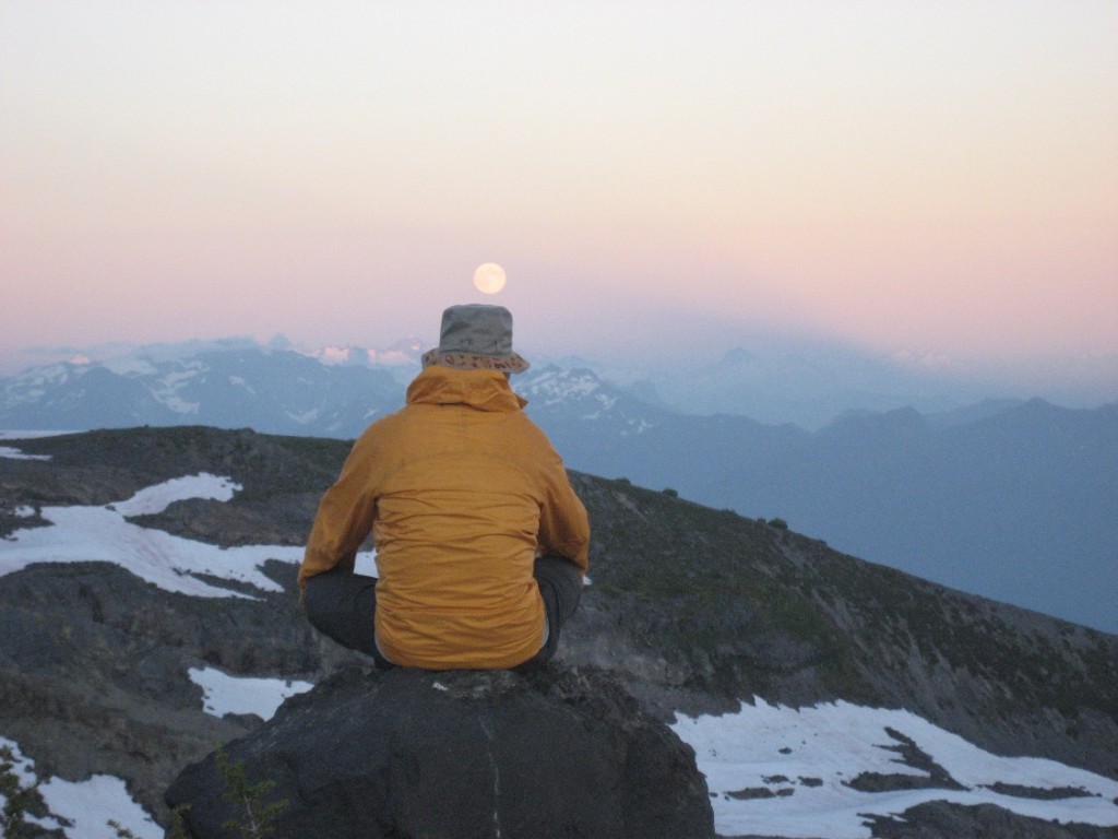
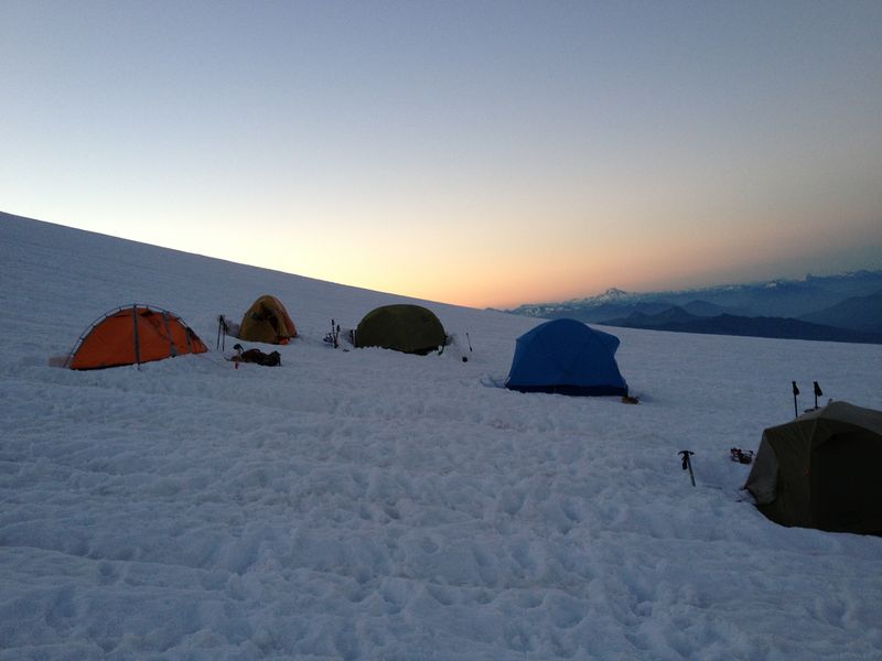
We camped at the Sandy Camp at the edge of the snow line on the first night, around 6000 feet, and practiced some knots in the evening. Cooking was surprisingly easy (and delicious) with rehydrated food. We just added hot water to the food package, waited, and then ate. The sun soon went down, but it didn’t get much darker as we watched a massive Moon emerge behind a rocky ridge in the east. It was calm and mesmerizing. We slept that night in tents with long moon shadows.
The next morning, expedition leader, Vince had us practicing our ice axe self-arrests and setting up our rope teams. Self-arresting is a safety skill used when a mountaineer loses their footing and begins to slide down the slope that may end up in a crevasse or a cliff. The idea is to spin onto your belly and dig the pick point and adze head of your ice axe into the snow in order to stop the sliding.
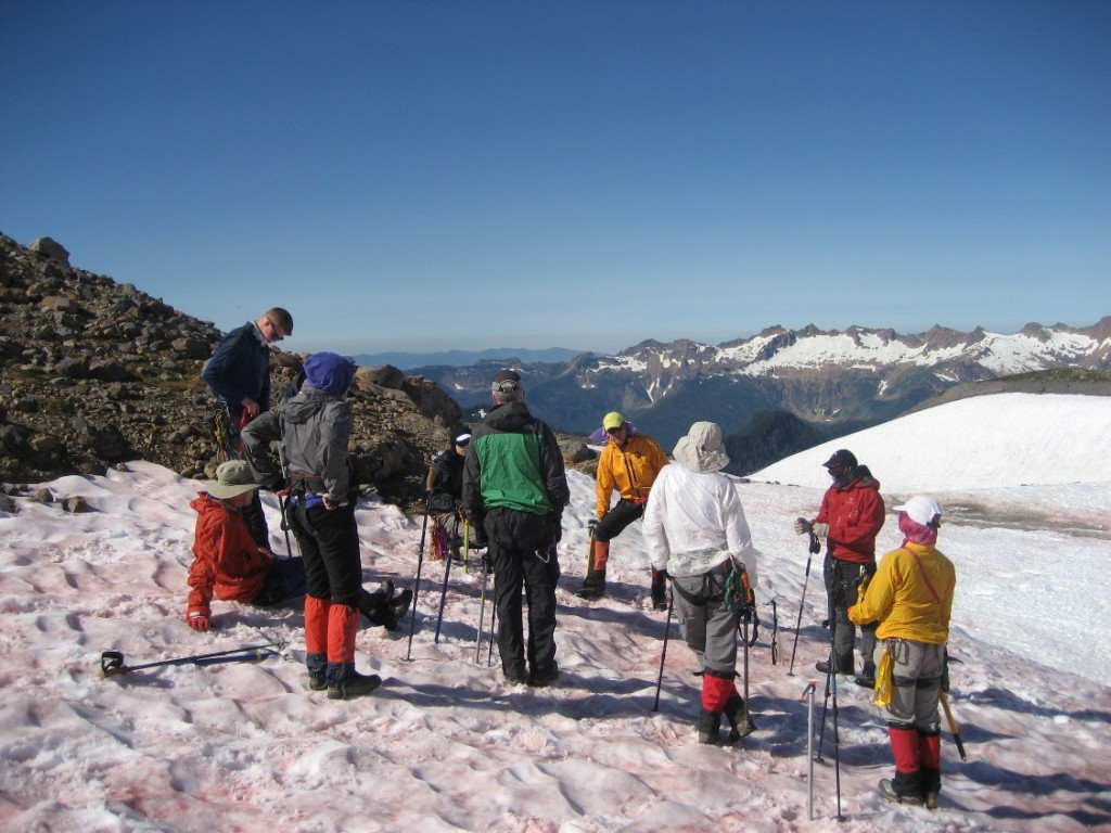
We began to climb again after a quick lunch. Moving on a rope team is a unique experience. The idea of a rope team is that should one person fall though an ice bridge or into a crevasse, the rest of the team would stop the fall and rescue the person. I was at the back, behind Hazel, Kevin and John leading and so the 3 people in front of me determined my pace. If I went to slow the rope would become too tight and the rest of the team could not continue. If I went too fast there would be too much slack in the rope and I risked stepping on the rope, which damages the rope, especially with crampons.
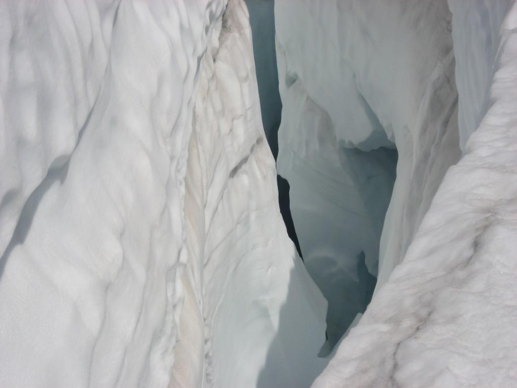
We soon crossed our first crevasse. Crevasse crossing needs to be done carefully, one at a time with a “tight” rope to minimize the distance you would fall. For a wide crossing, the rope teams should anchor themselves in with their ice-axe for additional safety. We had the proper equipment and training so we managed to cross most crevasses easily, but looking down a crack that goes on forever can still be unsettling.
During the day, the sun is hot and intense with reflections often eliminating any hope of shade. It is easy to get sunburnt even with strong sunscreen. But the temperature drops quickly once the sun goes down.
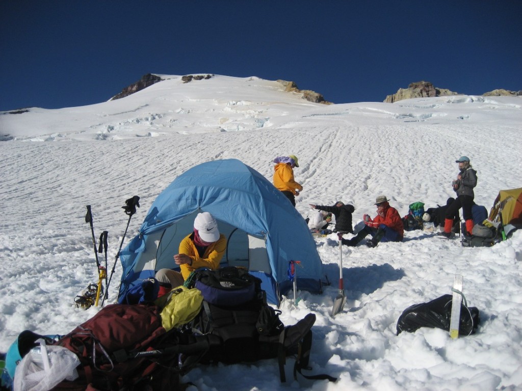
That night we camped on the glacier at about 8000 feet. We dug into the snow and secured our tents into the snow in case of strong winds. The night was cool, but Kevin and I had an incredible view out of our tent.
We crashed early that night and were up and on the move by 5:30 am in order to take advantage of the harder snow. This was a summit day, so we left the tents and unnecessary gear at the camp to reduce the weight at higher altitude and thinner air. The peak was so close, but had never looked further away. The final ascent was filled with switchbacks in order to avoid large crevasses, but we still crossed a few. About a third of the way up I started to smell something a little rotten. I hoped it wasn’t me; luckily it was the fumorale steam from sulphur in the nearby Sherman Crater. The slope became steeper and at one point, we had to go into a crevasse and climb out of it again. Soon after that, we crested and we saw the nipple on Sherman Peak below us on the right and the small rocky peak ahead of us was visible about a ½ mile away.
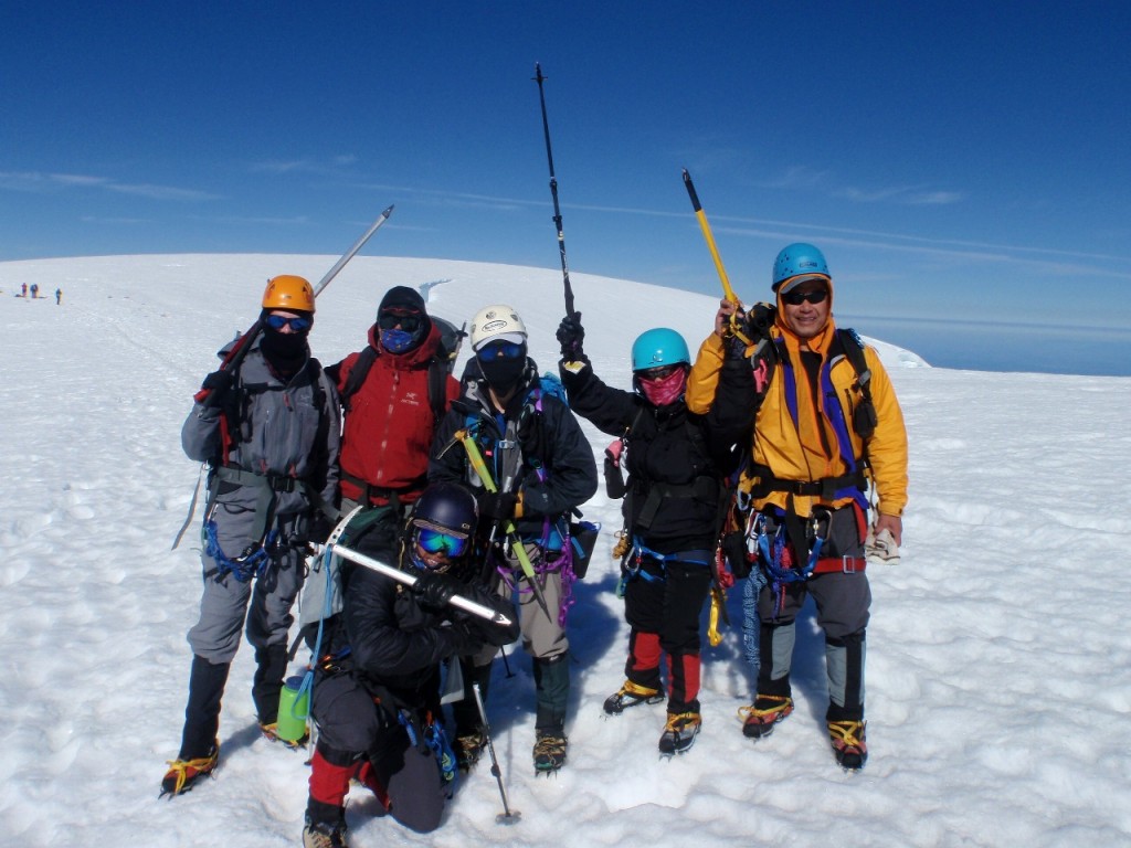
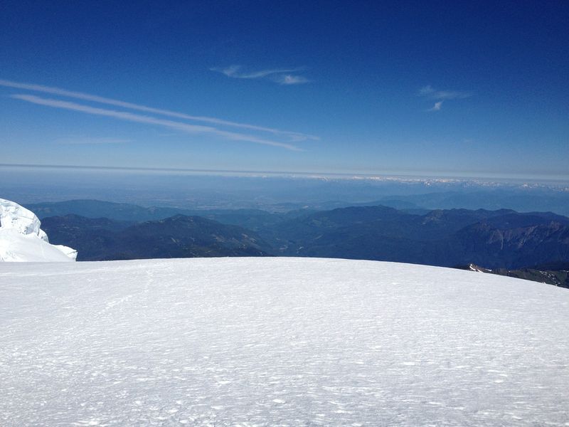
It was windy at the summit, but I enjoyed the cool air. From the summit we could see the blurry outline of the Vancouver North Shore Mountains and Mt. St. Helens, Rainer and Glacier Peak to the south. We signed the summit logbook and took some obligatory photos. This was only the halfway point of our trip. In climbing, more accidents happen on the way down than on the way up because of gravity and fatigue.
As Ed Viesturs said: “Getting to the top is optional. Getting down is mandatory.” I found the descent to be more challenging. My ankles felt the pain and my face was feeling the heat of the sun. Three hours later, we were back at camp just past noon. The powerful sun and reflection of the snow had burnt through my knit balaclava and I had gotten a nasty sunburn. I spent the rest of the day in the tent avoiding the sun. Thanks to Kevin for cooking while I was in the tent and Lawrence for the awesome afterburn gel and Hazel’s snow cooling technique.
The next morning we broke camp and headed back down the slope, taking a slightly different route to avoid some major crevasses. I gave my ankles some relief by sliding on my rear as much as I could. We had a break at the site of our first camp. It was amazing to see how much snow had melted in the two days since we left. The camp was also much greener now. The plants know the season is short.
The hike down is always prettier than the hike up. Back at the trail head we changed clothes and had a quick wash in the creek. 6 hours after we broke camp we were at Martin and Ann’s beautiful home in Bellingham enjoying a well-earned barbecue. It was a perfect ending to a perfect climb.
Before I joined this Rover Crew, I would never dream of climbing Mount Baker. I didn’t have the skills, the fitness or the people to do it. Mount Baker was just a mountain in the States that I would see on clear days. Now it is a trophy, a reminder of one of my proudest moments. A moment that this Crew made possible.
It took 6 months to train for Mount Baker. It took 3 days to climb the mountain. It took 5 days for my sun burn to heal. It took a month for me to get the feeling back in two of my toes. But I will never forget the blurry outline of the North Shore Mountains and my home so many miles to the north. Nor the feeling in my chest as my heart pounded with the beat of accomplishment.
Mt. Baker will never be the same again when I look at it from Vancouver.
Many thanks to Scouter John Wong, Expedition Leader Vince Poulin, and the rest of the expedition members for the incredible experience.